Topography Stereo Pairs (Cross-eyed Viewing)
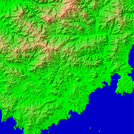
Southern Izu Shizuoka Prefecture in Japan
It is the area of Shimoda-shi and Minamiizu-cho. The north sides of a figure are north latitude 38-degree 44-minute and 15 seconds, and east longitude 138-degree 51 minutes and 33 seconds in Mt.Basara (608.4m). The name of Basara is Sanskrit. The place where the east of a figure became intricate in Shimoda-shi becomes the Shimoda harbor.
This figure is 14.6km. Latitude 9-minute and 12 seconds, and longitude 11 minutes and 30 seconds
This figure is 3D CG created by its own program based on the altitude data of "Digital Map 50m Grid (Elevation)" of "Geographical Survey Institute Government of Japan issue."
 Parallel viewing
 ANAGLYPH
All Right Reserved.
No reproduction or republication without written permission.