 Topography Stereo Pairs(ANAGLYPH)
 Topography Stereo Pairs(ANAGLYPH)
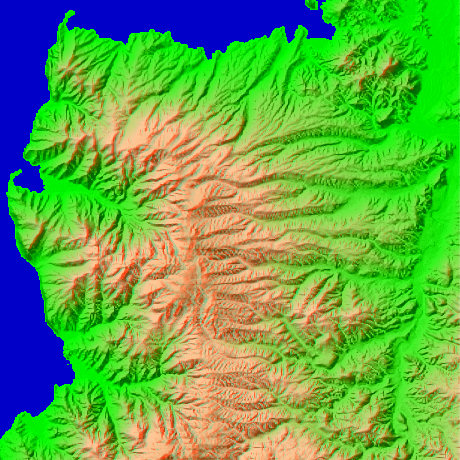
Izu city Shizuoka Prefecture in Japan
The peaks from the central left of a figure are north latitude 34-degree 57-minute and 17 seconds, and east longitude 138-degree 50 minutes and 21 seconds in Mt.Dharma (981.9m). It can look afar at Mt. Fuji north, and Amagi-san is visible to southeastern one. East one becomes Shuzenji.
This figure is 14.6km. Latitude 9-minute and 12 seconds, and longitude 11 minutes and 30 seconds
This figure is 3D CG created by its own program based on the altitude data of "Digital Map 50m Grid (Elevation)" of "Geographical Survey Institute Government of Japan issue."
 Cross-eyed viewing
 Parallel viewing