Topography Stereo Pairs (Cross-eyed Viewing)
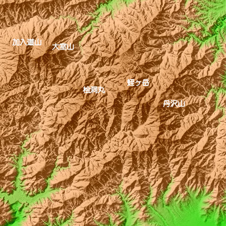
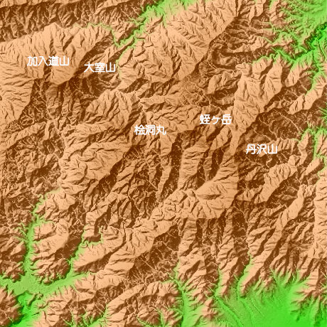
Tanzawa Kanagawa Prefecture in Japan
The northwest of a figure and Mt.Kanyudoyama (1418.4 m) is North latitude 35-degree 30-minute and 35 seconds, and east longitude 139-degree 2 minutes and 46 seconds. Mt.oomuro (1587.7 m), Mt.Hirigatake (1673m) of the highest peak, and Mt.Tanzawa (1567.1 m) are located east longitude 139 degrees for 28 minutes and 27 seconds north latitude 35 degrees at 9 minutes and 45 seconds. Tanzawa area has many peaks, also has many mountain trails and is fixed.
This figure is 14.6km. Latitude 9-minute and 12 seconds, and longitude 11 minutes and 30 seconds
This figure is 3D CG created by its own program based on the altitude data of "Digital Map 50m Grid (Elevation)" of "Geographical Survey Institute Government of Japan issue."
 Parallel viewing
 ANAGLYPH
All Right Reserved.
No reproduction or republication without written permission.