 Topography Stereo Pairs(ANAGLYPH)
 Topography Stereo Pairs(ANAGLYPH)
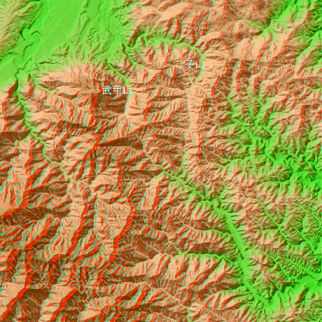
Chichibu Saitama Prefecture in Japan
Since it is the mining ground of the limestone of cement materials in Mt.Buko (1304m), altitude becomes low in the mountain at the southernmost end of the Chichibu basin. Positions are north latitude 35-degree 57-minute and 5 seconds, and east longitude 139-degree 5 minutes and 52 seconds. 8 minutes and 16 seconds are in the east side north latitude 35-degree 57-minute and 42 seconds, and east longitude 139-degree 8 minutes and 16 seconds
This figure is 14.6km. Latitude 9-minute and 12 seconds, and longitude 11 minutes and 30 seconds
This figure is 3D CG created by its own program based on the altitude data of "Digital Map 50m Grid (Elevation)" of "Geographical Survey Institute Government of Japan issue."
 Cross-eyed viewing
 Parallel viewing