Topography Stereo Pairs (Cross-eyed Viewing)
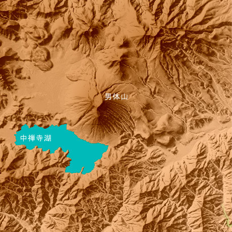
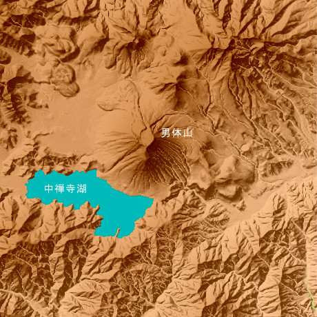
Mt.Nantaisan Cyuzenji Lake Tochigi Prefecture in Japan
Mt.Nantaisan (2397. seven m) is a mountain representing Tochigi Prefecture, and is in north latitude 36-degree 46-minute and 6 seconds, and east longitude 139-degree 29 minutes and 1 second. Chuzenji Lake is a lake which the river was dammed up and was able to do it in the eruption of Mt.Nantaisan, and the Kegon waterfall which hits an outflow mouth is one of the beautiful waterfalls.
This figure is 14.6km. Latitude 9-minute and 12 seconds, and longitude 11 minutes and 30 seconds
This figure is 3D CG created by its own program based on the altitude data of "Digital Map 50m Grid (Elevation)" of "Geographical Survey Institute Government of Japan issue."
 Parallel viewing
 ANAGLYPH
All Right Reserved.
No reproduction or republication without written permission.