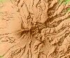
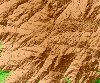
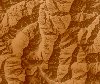
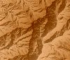
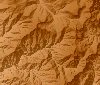
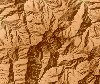
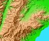
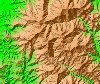
3D topographical map
Last update May.25.1999
| Click on |
 |
to Parallel-eye viewing. |
| Click on |
 |
to Cross-eyed viewing. |
| Click on |
 |
to Anaglyph viewing. |
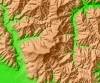
| Mt.Daisen |
Mt.Miyanoura |
Mt.Yari |
Mt.Kasa |
Mt.Mitsumata |
 |
 |
 |
 |
 |
 |
|
|
|
|
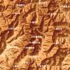
| Mt.Ishizuchi |
Mt.Hira |
Mt.Uwajima |
Mt.Mikami |
Mt.Ibuki |
 |
 |
 |
 |
 |
|
|
|
|
|
Large size 3D topographical map
The topographical map of this page consists of 450x450 pixels. It will disturb, if screen size is not 1000 pixels or more in width. If wide range geographical feature is Viewing 3D, geographical feature will appear and go up vividly. In a plane topographical map, the feature which is not known is known well.
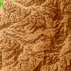
| Kamikochi |
Mt.Kurobe |
Mt.tsurugi |
Mt.Fuji |
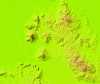
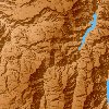
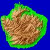
Yaku Is. |
 |
 |
 |
 |
 |
 |
|
|
|
|
This figure is 3D CG created by its own program based on the altitude data of "Digital Map 50m Grid (Elevation)" of "Geographical Survey Institute Government of Japan issue."
All Right Reserved.
No reproduction or republication without written permission.
Please mail comments and suggestions to
My mail